License System
The software requires a USB license dongle for full functionality. Without the dongle, you can only use the software in demonstration mode. In this mode, it is not possible to open CSV files from the total station; instead, you can only view with a preloaded table file.


Wizard
Open Data File
1️ Load your Total Station data file.
2️ Select the measurement adapters used.
3️ Assign measurement points from the loaded CSV file.

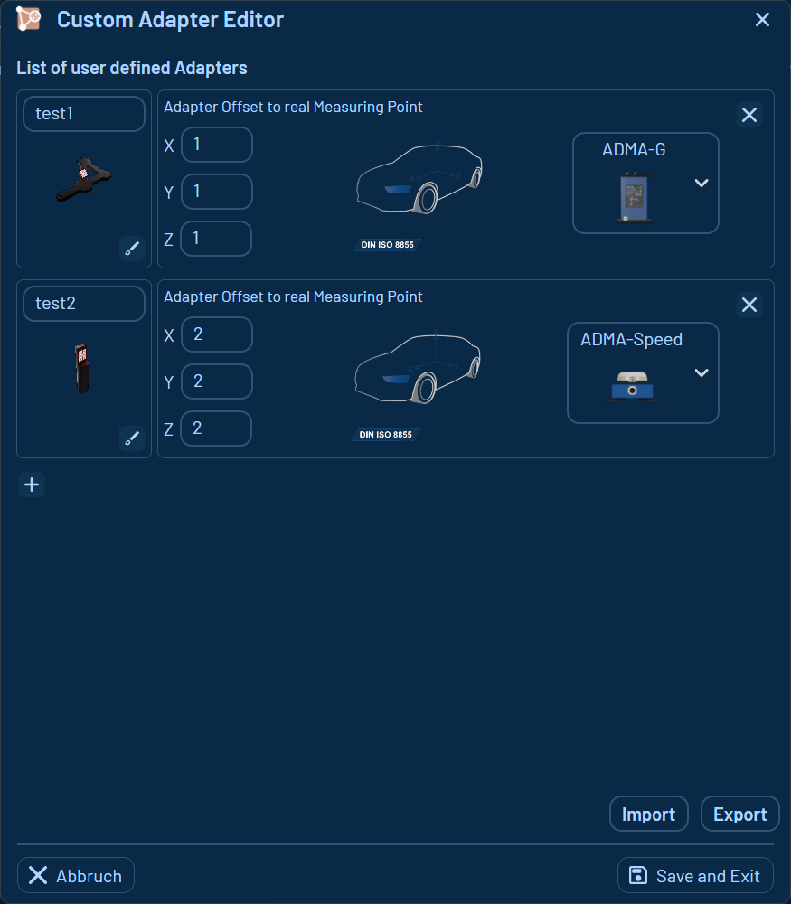
With Custom Adapters it is possible to integrate your own adapters with their offsets. These adapters can be exported (as ZIP) and imported.
Vehicle Assignments
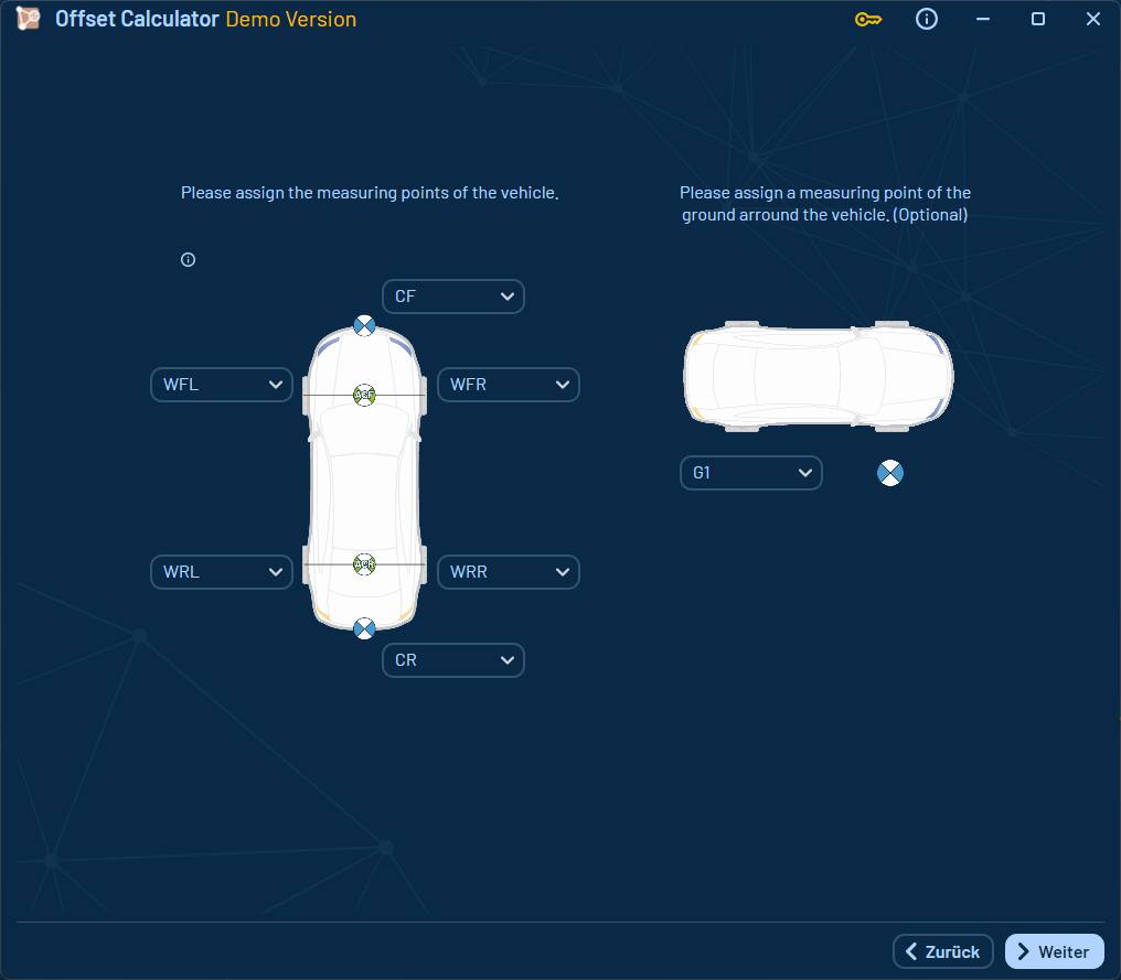
To enable visualization and calculate ACF (Axis Center Front) and ACR (Axis Center Rear), the points shown in the schematic must be measured.
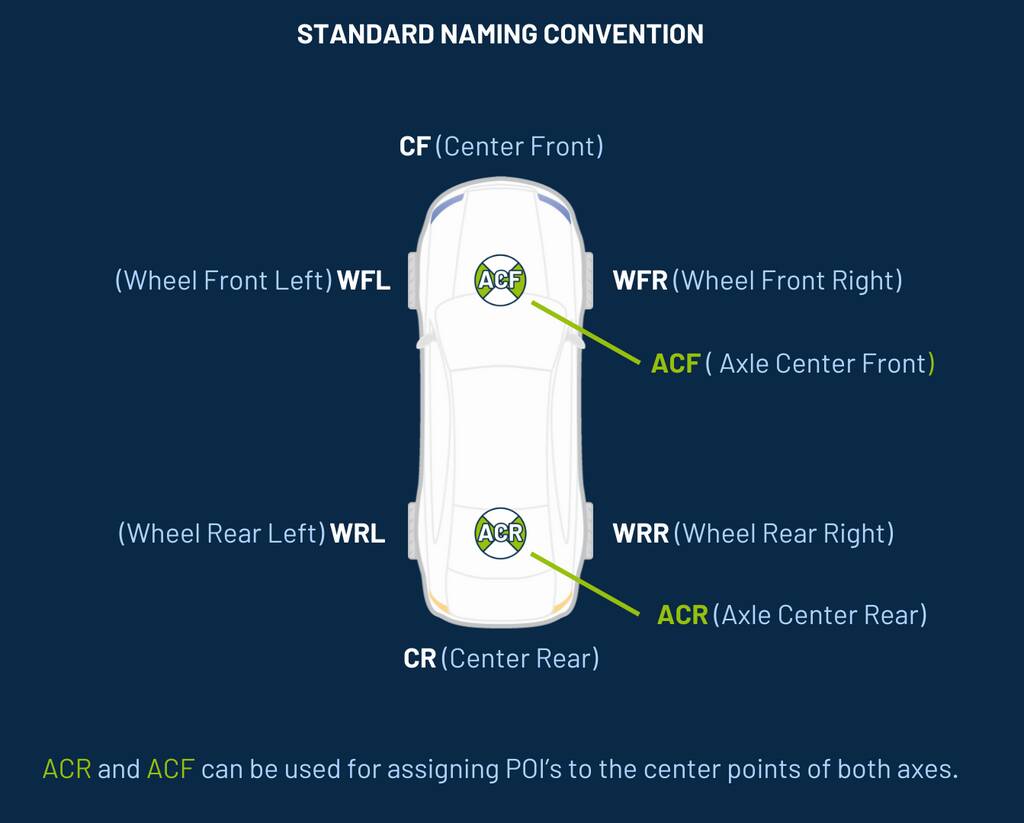
Assign these points in View 2 of the Wizard.
Ground Measurement Point (Optional): Required only if height values relative to the ground are needed.
Optional Assignments
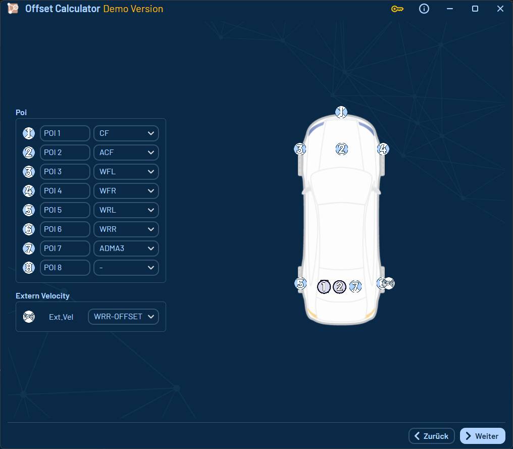
In the next view, assign optional points on the vehicle. Points of Interest (POIs) and the external velocity system are visualized in the schematic on the right-hand side.
Note: The axis center points (ACF and ACR) are calculated automatically and can be used for POI assignments.
Results
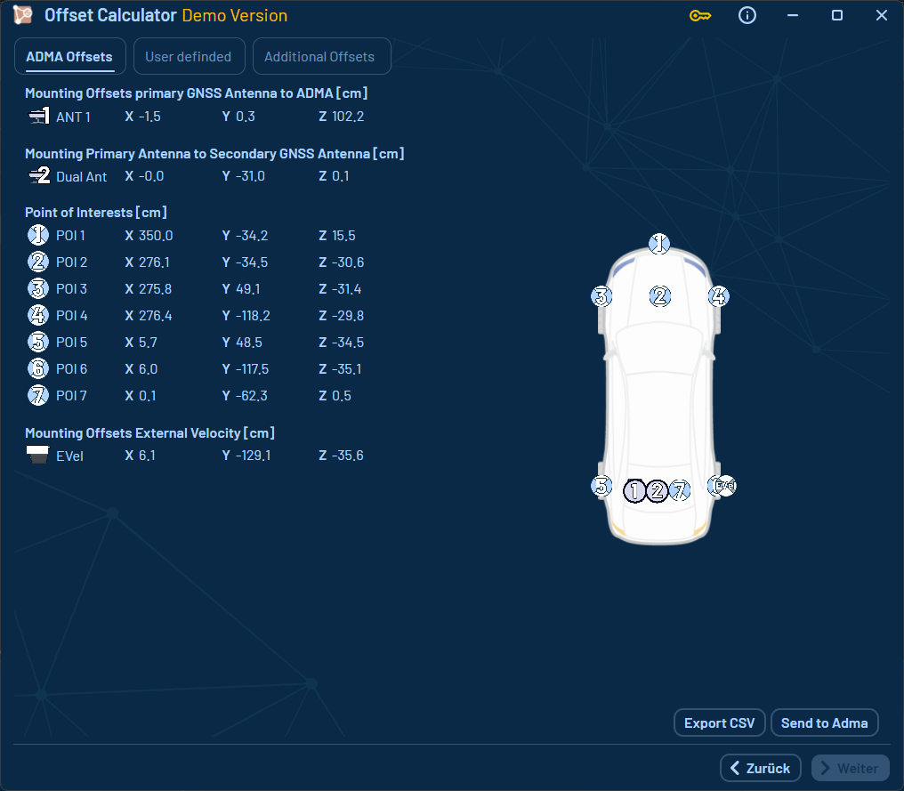
ADMA Offsets
All required offsets between sensors, antennas, and optional points are calculated. These offsets can be sent directly to the ADMA system or exported as a CSV file.
User Defined
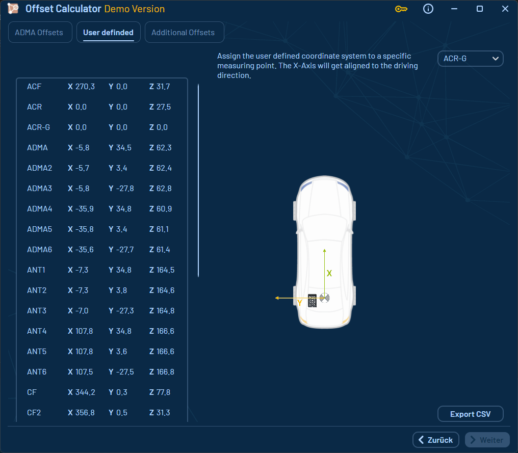
In the User defined results you have the possibility to define an own coordinate system be assigning a measurement point of the input CSV file. The X-axis will be aligned in the driving direction.
With this feature, you can no longer only measure ADMA offsets but measure positions of additional systems like radar or lidar sensors for example in relation to the vehicle and output them in your own coordinate system. This enables you to import these standardized CSV files in your own software for example.
Additional Offsets
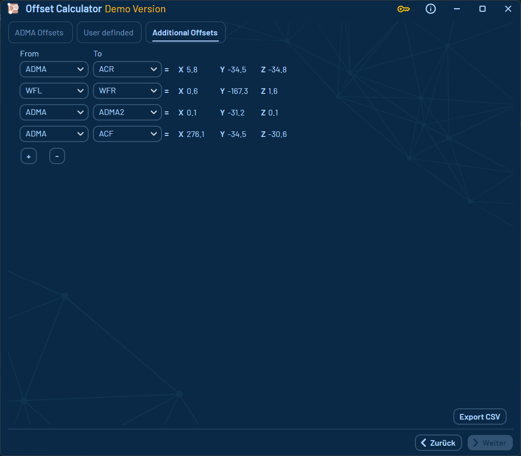
At Additional Offsets, you are able to select two user defined points and calculate the x, y and z offset directly. The list of all added points can be exported as CSV file.
