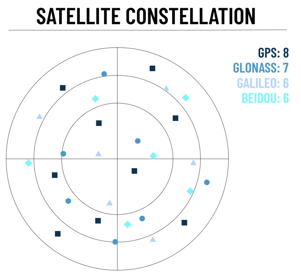
There are always areas of poor or insufficient satellite availability when performing measurement runs in urban areas. The GNSS receivers used by the ADMA system have the option of accessing multiple satellite systems (multi GNSS), i.e. GPS, GLONASS, Galileo and Beidou. The use of multiple satellite systems increases the pool of accessible satellites and consequently the actual number of satellites used during measurement runs. This offers the benefits of reduced signal acquisition time, improved position and timing accuracy and fewer problems caused by obstacles such as buildings and foliage. The use of multi GNSS moreover leads to an improved spatial distribution of visible satellites and, therefore, higher positional accuracy.
Reliable driver assistance systems and automated driving in urban areas are playing an increasingly important role in the automotive industry. This is exactly where the greatest challenges for GNSS receivers lie in terms of validating driver assistance systems.
Signal Shadowing

GNSS stands for Global Navigation Satellite System and includes the satellite systems GPS, GLONASS, GALILEO and BEIDOU. For a valid and very precise position solution, the GNSS receiver requires at least 6 different satellite signals. Modern GNSS receivers are capable of using all satellite systems simultaneously and intersecting the best satellite signals in each position. This enables navigation in situations where one satellite system alone would not be adequate, such as in urban canyons, tree-lined avenues, narrow alleyways and beneath bridges. The situation becomes particularly critical when the GNSS receiver receives reflected satellite signals: the so-called multipath effect. In such cases, the receiver may include incorrect information when calculating the position solution, resulting in decreased accuracy. The more satellites the GNSS receiver can use for solution determination, the greater the likelihood of compensating for or eliminating these multipath effects.
Interurban Measurements

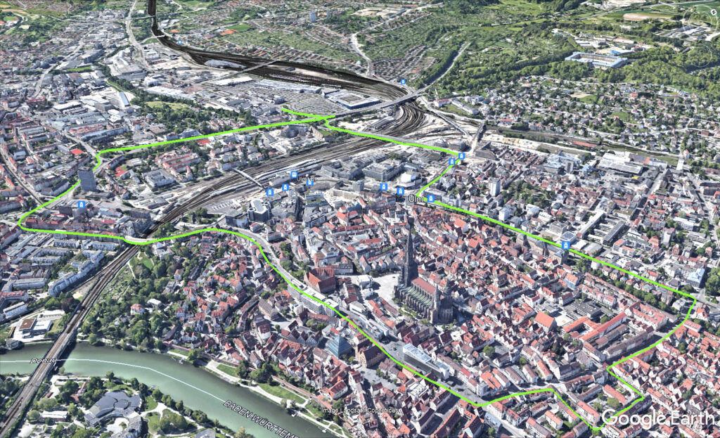
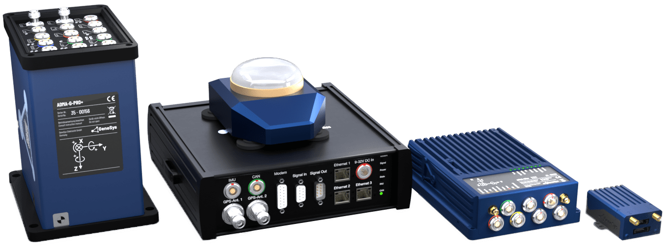
In order to translate theory into practice, a vehicle was equipped with two ADMA-G-Pro+ inertial systems in order to generate measurement data under real environmental conditions during a 22 km test drive through Ulm. During this inner-city test drive, the first measurement system was GPS- and GLONASS-enabled, while the second ADMA system utilized GALILEO and BEIDOU in addition. Both inertial measurement systems were connected to the same GNSS antenna and provided with the same correction data.
Performance Enhancement for Measurement Results
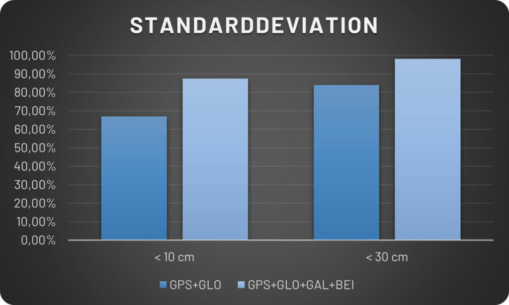
The automotive manufacturers and suppliers work with KPIs (Key Performance Indicator). In order for measurement data to be used to validate studies, certain KPIs must be met. For example, a standard deviation of 10 cm for positioning data can be defined as a KPI for Ground Truth data. For this measurement scenario, 66.93% of the measurement data could be used for validation if GPS and GLONASS satellite systems were activated, and 87.34% if GPS, GLONASS, GALILEO and BEIDOU satellite systems were activated. The user would thus have to drive 20.4% less distance to get valid measurement data. The primary cause of this is a reduction in the standard deviation, because the measurement system can measure in significantly more track sections in RTK2 mode, since the average number of satellites is significantly greater. The standard deviation reduces, therefore becoming better. The reason for this is the use of Multi GNSS with the much larger number of usable satellites and associated longer availability of the RTK2 solution.


Conclusion
Overall, an upgrade to Multi GNSS with all four satellite systems clearly shows that a significant performance increase can be achieved, especially in environments with challenging conditions for the GNSS receiver. In order to achieve maximum data integrity, it is also recommended that Multi GNSS is enabled on the receiver side. Furthermore, this ensures higher reliability, more valid measurement data, higher accuracies and better error compensation.
We recommend the use of Multi GNSS as soon as phased poor satellite reception is suspected during measurements.
Especially when a high level of data integrity is required, enabling Multi GNSS capability for the inertial system’s GNSS receiver is recommended.
Find here further informations: https://genesys-offenburg.de/en/adma-options-and-add-ons/


